A guide to DIY bike route maps: How the Richmond, Indiana bike route was made
In 2008, Richmond, Indiana had maps printed for a network of recommended bike route map developed by experienced cyclists. The city government endorsed and supported the project but was did not lead the effort or fund it.
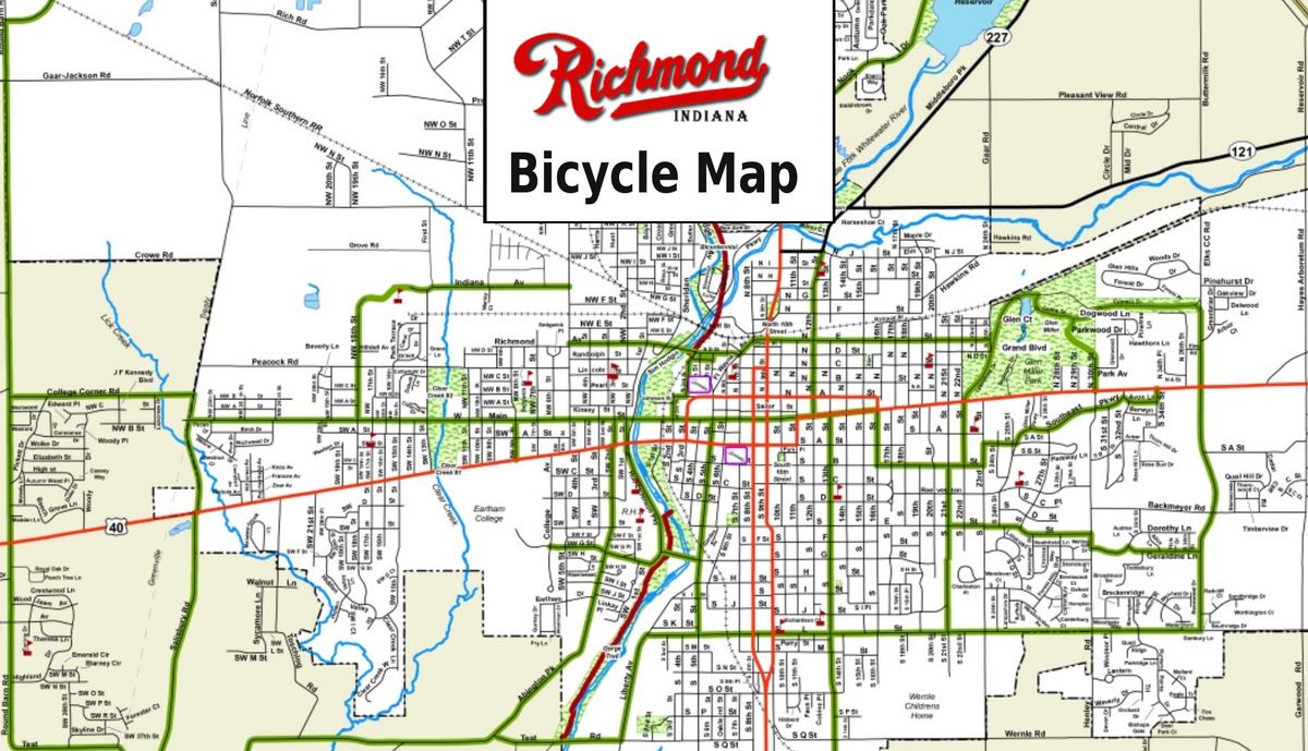
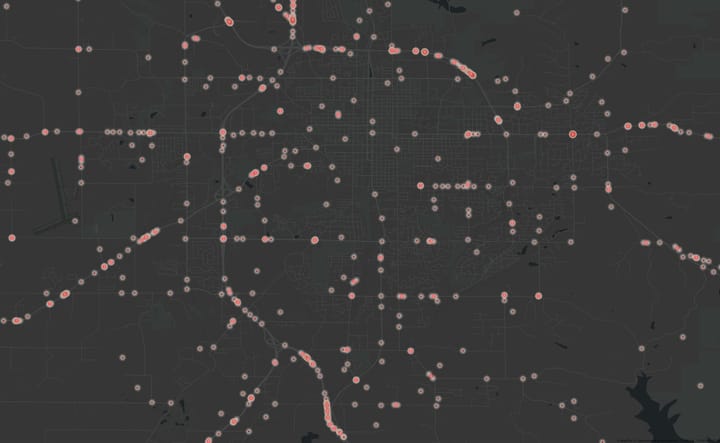
You can preview the front and back of the 17×22 map online.
I hope that by sharing my experience, other motivated citizens can create bike maps for their towns, without waiting until their governments have both the time and money to produce them officially.
If there’s a quick summary to process, it’s this: Anyone is welcome to design and print a map, and it is experienced cyclists, not city bureaucrats, who are most qualified to determine what recommended bike routes should be.
Form a Bikes-as-Transportation organization
A person representing a group is more likely to get the attention of the city than person speaking out of their own personal interest. That was one motivation to start “Bike Richmond”. I also wanted to provide a transportation focus to compliment an existing bike group in town which focused on recreational riding. Involving other experienced cyclists would also provide great feedback on a bike routes, and set the foundation for organizing events.
However, I didn’t want the overhead of setting up a real non-profit legal entity, having a board of directors or regular monthly meetings. Instead, I created a free Google Group and bought the bikerichmond.org domain and redirected it the google group. The domain costs about $15/year, and a Google Group takes just a few minutes to set up.
Since Google Groups provides a membership count for the group, we had an official group count that I could refer to, and I could generally then say that I now represented “Bike Richmond”. Many details were discussed on the list and we generally closed with a consensus about direction.
To further help make the lightweight organization “official”, I designed a simple business card for the organization (download the compressed PDF) using the free gLabels program Since it just mentioned the website address without a specific name on them, any group member was able to take some and distribute them if they’d like.
The simple promotion helped get the name out and grow the organization.
Draft the initial bike route network
Google’s My Maps feature came out just about the time the project started, and I used a similar tool to prepare the first draft of recommend bike routes. At the time, there wasn’t the feature for multiple people to edit the same map, but they’ve since added that feature to Google MyMaps. I recommend Google’s My Maps for collaboratively creating and sharing drafts of bike routes.
“My Maps” also offers the feature to add photos to the map. So, if someone has a question about a particular stretch of road, they can click on the photo and see an example of it, assuming I had taken a photo there and uploaded it. The need for using that feature has somewhat been eclipsed by Google StreetView where it is available.
After getting some feedback from other riders, I was prepared to initially present the idea to the City to get the city’s initial response to the concept. At this point, my question for the city would be: “If I worked with experienced cyclists to develop a final draft of recommended bike routes, would the City consider approving the network as an official network of recommended bike routes?”. I was clear that the simply approving the network could be the first phase of the project. Working out funding for maps and signs could come later. By separating out the funding issues, our cash-strapped city would have an easier time approving the project.

Present the Bike Routes Concept to the City
Through a contact in the “Metropolitan Development Department” I got an audience with a “Transportation Committee” which was tasked to implementing the transportation related aspects of the City’s Comprehensive Plan. The Plan among other things directs the city to complete a network for “motorized and non-motorized transportation”.
Given that, I pitched my project has helping the City to meet it’s own stated objectives.
I also understood that getting support from the City meant more than just showing off map and getting a thumbs up.
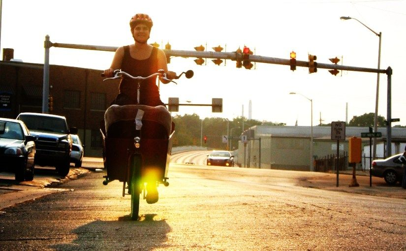
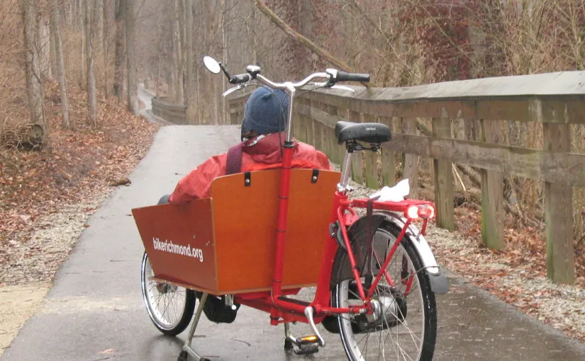
I spent most of my 10 minutes with the mic to brief the group on a vision of a bike-friendly community. I used a photo-heavy slideshow with background music to show off XtraCycles, Bakfiets, velomobiles and sensible european commuting bike fashion. I think this actually worked to get the group more exciting about bicycles. Having set the mood, I used the last few minutes to show of the draft of the map. I was invited to present a final draft to the Transportation Committee for their approval, who could in turn recommend the network for approval by the Mayor.
I also came prepared with a lot of bicycle safety statistics in my back pocket. Not wanting to frame the conversation around safety, I didn’t bring up the topic much, but I was well-prepared to discuss the reality of cycling safety if someone else brought it up.
Research Great Bike Maps
Our community needs a lot more than a bike map. We need a large dose of bike education. While the map itself would take up one side of the document, there is some freedom with what can go on the back of map.
I wanted this map content to be the best possible. First, I collected as many bike maps as I could. I contacted the Indiana Bicycle Coalition, the Indiana Department of Transportation and the Indiana Department of Natural Resources to find out which other cities in the state already had bike maps, and how I might get a hold of their maps. All of these organizations were helpful in supplying either consulting, maps or references for further contacts.
However, it was by luck that local cyclist Jane Holman gave the best map I’ve seen: from Albuquerque, New Mexico. Our map design and content is based most closely on theirs. It includes several sections of information:
- Local bicycle laws
- Local bicycle photos
- Local bicycle shops
- How to get a bike on and off a bus rack
- Biking to Work
- Infographics, to illustrate key safety points
- Considerations for Moms and Dad
The “local” portions were easy enough to take care of. (I copied the local bike laws off the city website), and local photographer Jane Holman contributed some photos.
That left three sections of the Albuquerque map that I wanted to model. I was able to get explicit permission in each case to re-use the content directly. The safety graphics were credited to Calgary, Canada and by contacting Ken Richardson there, I was given high quality source files of the same graphics to use for this project.
The “Moms and Dads” text was traced to Kalkomey Enterprises, and I successfully contacted Kurt Kalkomey and received permission to re-use this text as well. The “Biking to Work” text actually originated in Albuquerque, and James Arrowsmith there gave me permission to re-use that.
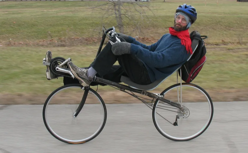
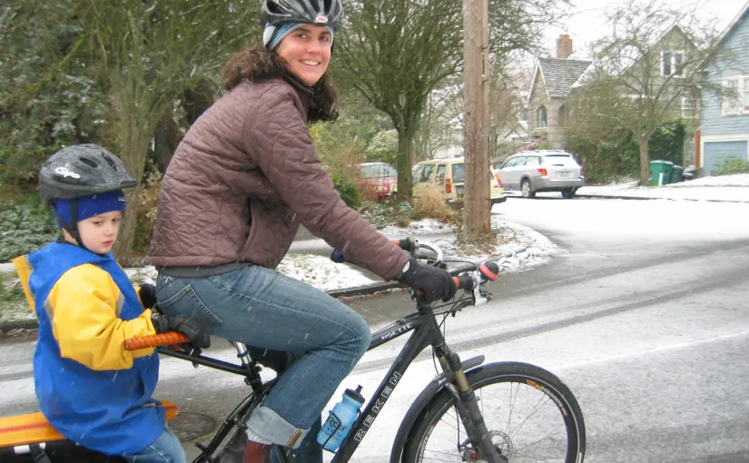
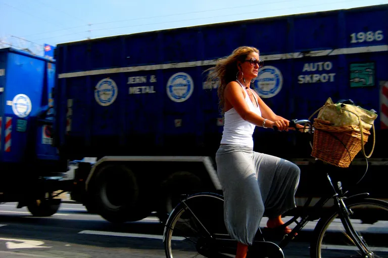
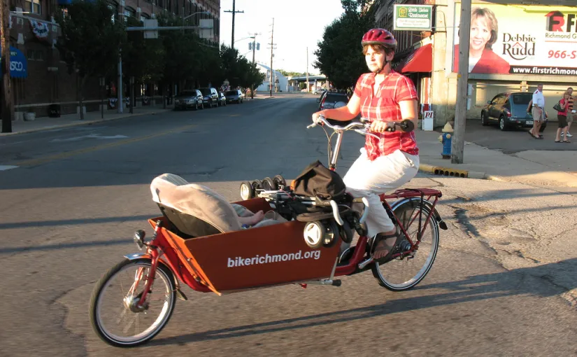
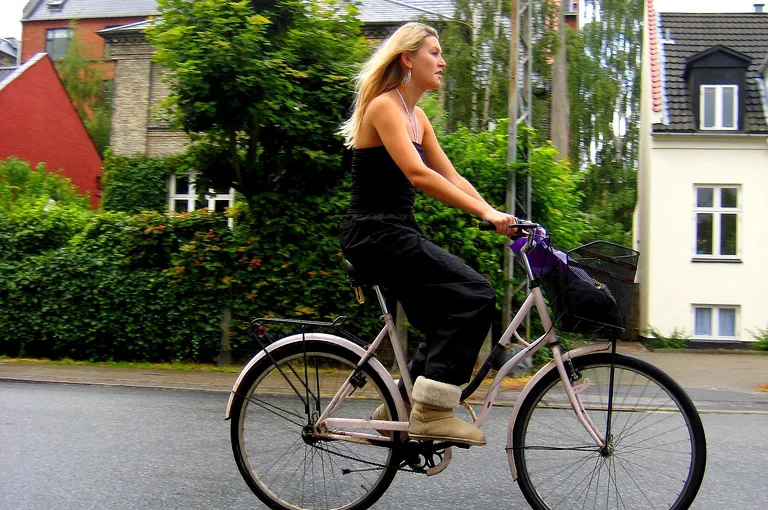
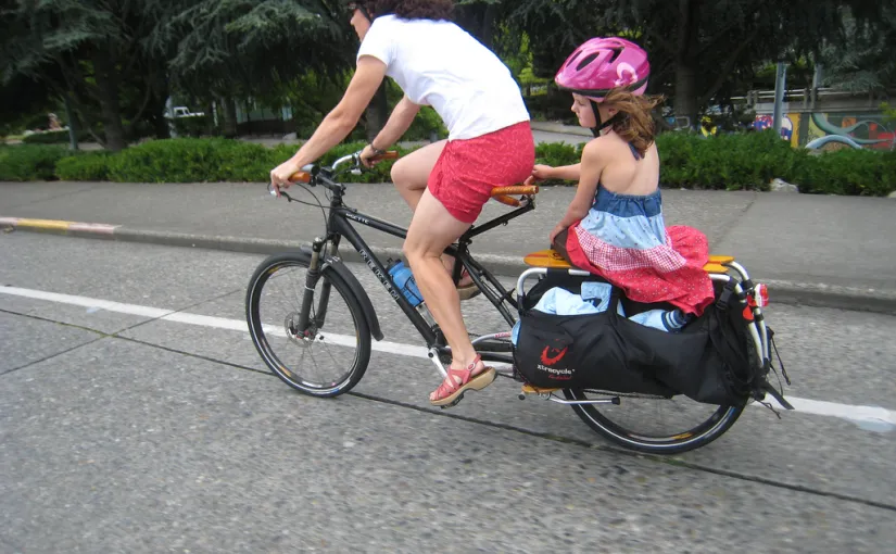
I really wanted to use the photos to show different ways of cycling– something besides mountain bikes, road bikes and spandex. One photo is of a recumbent bike. (Actually, it’s me…) I also really wanted a photo of a XtraCycle being used as a family bike. No one in town had one at the time, but I think they may be a great antidote to cargo and kid hauling in the face high gas prices, once people discover them. So I got permission to re-use a photo from carfreedays.com of a mother riding a child to school in light snow.
Refine the Bike Routes
Using the newly form bikerichmond.org group, we had multiple meetings where we would ride part of the routes together as a group, and then review the current draft map and discuss it.
The group review process was very valuable. Other riders suggests routes I wasn’t aware of, cited reasons to avoid some of the routes I had recommended, and suggested useful tweaks as well. (“If you just move this segment one block over, it will go right by the museum”).
Every time changes were made, I would post a new draft to the mailing list, listing out all the changes and why we made them. The process repeated until the list was quiet with refinements. Some rules of thumb we developed:
- If in doubt, leave it off. Getting the map produced at all is more important including any particular segment. Any controversial segment may or may not be a real safety issue, but the controversy itself could hold of the approval process.
- It’s OK if there are gaps in the maps. You’ll see them in the Albuquerque map. These represent areas that need infrastructure improvements to be recommendable. The gaps on the map become a great advocacy tool. “The map clearly illustrates three key problem spots for bike commuting. See here? We could really use a bike lane to get past the old Reid Hospital“
Present the Final Bike Route Network to the City
For the final presentation of the proposed network, I got a full size map of the city– the kind available to tourists. I carefully went over the recommended routes with a yellow highlighter.
At this point, there was surprisingly little discussion about the network, and relatively easy approval. And when there were questions, I was prepared to talk in detail about every segment– how wide the road was, how much traffic it had, and why experienced riders had suggested including or excluding it.
We now asked for official approval of the network itself in an abstract sense. Doing this required no commitment by the city to produce a map, put up signs or really do anything at all. We were simply asking them back up the group of experienced of cyclists with endorsing our work as an “official recommended network”. The Mayor approved it.
Design the Bike Route Map
For the front side of the map– the side that actually has the large map on it, our local City/County GIS department produced the map image and legend for the project at no charge. They were essentially tracing the map we created and it sounded like it wasn’t very hard for them. It helped that our contact there walked to work regularly and believed in the project.
If the city had not cooperated in this way, I would hope that we could get a basic map of the city of through an
“open records request”, and then overlay the routes ourselves, if necessary.
Some more details I included on the map:
- A photo and description of getting the bikes on and off the buses which had just gotten racks. I had this part approved
by the local bus organization. They were excited about the project because they considered both bikes and buses to be alternative transportation, which could strengthen each other. - A disclaimer of the City’s liability for the use of the map. I’m sure how much it’s worth legally, but it didn’t take up much space and I thought might improve the chance of approval. You can see an example disclaimer I found.
- A non-official city logo. If the city would pay for the maps, I would swap in their official logo, but that didn’t happen. Jim Hair let me use the great Richmond logo that he uses for his own promotion of Richmond.
Produce the Bike Route Map (with 100% free software)
With all my content gathered, I sought out the services of a professional graphic designer to put it all together and work with the printer. I failed at finding a volunteer for this, but ended up enjoying taking on this role myself. Although I hadn’t done print design in a long time, I had studied it in the past and had experience designing books and newspapers.
While I won’t go into detail about the graphic design process, I can tell you that I used exclusively free, open source software to complete the job, and felt efficient using these tools. The software involved included:
- Ubuntu Linux (operating system)
- Inkscape, for processing source SVG vector graphics from Calgary
- GraphicsMagick, to convert PDFs from the GIS office into hi-res PNG images
- Gimp, for photo processing and adding drop shadows
- Scribus, for layout
About the only especially technical thing I had to keep in mind was to try to use images that were 300 DPI or larger. I used one 150 DPI image anyway, and was still still satisfied with the result. Scribus took care of automatically converting the images to use the CMYK color space and output a high quality PDF, which the printing service was able to translate perfectly. The printing service doesn’t need to have Scribus. Indeed, they have never even asked which software produced the PDF I gave them.
Present the Bike Map Design to the City
Once the map design was substantially complete, I was invited back to meet with the city for a final presentation to the mayor and key department heads (Police, Parks, Streets, Metropolitan Development).
The agenda at this meeting included final approval, funding, signage and next steps.
I again emphasized that this work was supporting the Comprehensive Plan and showed another short slide show to present a positive vision of bike culture. I also went over all the valuable information the back up the map. There was support for the project, but not funding– budgets were already being cut all throughout the city. The idea of signing the routes was also supported, but lack of funds meant that would have to wait as well.
In talking about next steps, I boldly presented to the mayor a new job description– for the new bike/ped coordinator we need! (See the job description as a PDF, edit it as RTF). I emphasized that simply if the idea of having this position was desired, it might be possible to create it through a grant, as an internship or with a volunteer. With the cost of gas likely to continue to climb over time, it seems strategic for city’s to invest in something which can improve quality of life, quality of the air, health and transportation. I haven’t heard anything back about this, but I like to think a seed was planted.
Getting Quotes for Printing the Map
My first pass at guessing the cost of the maps was to ask nearby cities what they paid for theirs. I recall getting answers back in the range $1 to $3 per map. That turned not to be a very accurate way to predict my costs. Having an idea of what my specs would be and talking directly to printers turned to be to much more productive. I’m also glad I asked what 5,000 would cost to print when the answer I got back for 1,000 seemed expensive. The cost for 5,000 turned out to be less than double the cost of 1,000!
Here are the specs I used to talk to printers:
- 17″ x 22″ full color map, no bleeds,
- folded into 12 panels, (The same folded size as a tri-fold brochure)
- Printed on glossy, recycled paper (the gloss should help with rain resistance)
- Documents provided as high-quality, press-ready PDFs.
- Price points for 1,000, 2,000 and 5,000.
The size of the map required will vary some by the size of your city, and possibly with your budget. Albuquerque’s, for example, is a good deal larger than ours.
To get an idea of which printers could even handle printing and folding such a job, I asked around with other people that folded brochures in the community. The low quote was from Paust Printers, quoting $2,010 for 5,000 maps, about 40 cents per map.
Fundraising for a bike map
Now that I had a map and I knew how much it would cost to print, I had to raise money to get it printed. Having the map essentially completely ready at this point was definitely as asset, as I could show the full size draft to potential funders, making the project very concrete and real.
My approach to fundraising was to build a distribution network and raise funds at the same time, by asking potential distributors if they would be willing to prepay 40 cents per map for maps that I would give to them to give out.
I successfully signed up seven funders for the project including a bike shop, a hospital, a college, tourism and economic development groups and our local community foundation. I always asked for specific amounts and most people gave me what I asked for, in the $200 to $400 range. Perhaps I could have asked individual funders for more, but having a few more funders meant a broader base of support, and a larger built-in distribution network.
In each case, I pitch the benefits and relevance to the specific organization. When possible, I tried to drop by and show off the map in person, although a lot of the fundraising was done with simple e-mails.
I did not promise anyone up front that they would get their logo on the map or even their name, and no one insisted on this. I didn’t want to end up with a document that looked like a hodge-podge of corporate logos, like those event t-shirts no one wears in public once the event is over. In the end, I gave all the supporter a subtle text-only mention, which I hope provides sufficient recognition while keep the visual focus of the document on the key content.
Financial logistics of being a lightweight bike organization
While I enjoyed the informality of bikerichmond.org, this meant there was no legal entity that checks could be addressed to, and we did not directly qualify for one mini-grant from the Wayne County Foundation that we could receive if we were a formal non-profit or a government organization.
I shopped around for organizations or city departments that could be a “fiscal sponsor”– someone who would receive checks from supporters and write the check to the printer, but won’t necessarily provide any funds on their own. Such a sponsor organization would also allow us be the recipient of some kinds of grants.
A contact within the city advised me that trying to use a city department for even this expense-free task could add more red tape than it was worth. So, although I would like the map to be a public project of the city, eventually, I continued to work outside the city for now.
Eventually, our local Cope Environmental Center agreed to be an organization sponsor for the project. I was up front them that I expected this to be a short-term arrangement. If Bike Richmond continues to have a financial life, it makes sense to becoming a formal legal entity.
Thank Yous
With the maps back from the printer, it’s important to remember to send “Thank Yous” to donors as well as mailing sample maps to everyone who contributed, such as the organizations that granted me permission to re-use some text or photo in the document.
My “Thank you list” includes the following the organizations:
- Cope Environmental Center
- Cycling and Fitness Warehouse
- Earlham College
- Earlham Bike Co-op
- Economic Development Corporation of Wayne County
- Ike’s Bicycle Shop
- National Road Heritage Trail
- Summersault
- Reid Hospital and Health Care Services
- Richmond High School
- Richmond/Wayne County GIS
- Rose View Transit
- Wayne County Convention and Tourism Bureau
- Wayne County Foundation
- Wayne County Surveyor’s Office
- The City of Albuquerque, New Mexico
- The City of Richmond, Indiana
- The City of Bloomington, Indiana
- The City of Calgary, Canada
- Indiana Department of Natural Resources
- Indiana Department of Transportation
- Indiana Bicycle Coalition
- WayNet, Inc
- carfreedays.com
- Kalkomey Enterprises, Inc
Plus many more individuals not affiliated with one of the above organizations who provided valuable feedback or assistance:
- Anna Lisa Gross
- Barry Cramer
- Jim and Vicki Hair
- John Weber
- Steve Melamed
- Hopi Stosberg
Plus some others I’m forgetting, I’m sure. Thanks!
Distribution and Beyond
We are currently in the distribution phase. I’m using a simple spreadsheet to list out my major distributors (who are often the funders), along with how many maps they are getting. A simple formula then calculates how many maps are in the remainder pool that may be available for other purposes. Even before the maps are back from the presses, the maps are in demand. Earlham College wants at least 1,000 copies, and Richmond High School has asked to have a copy for each student (over 1,600). I expect the first printing of 5,000 will find it way to prospective cyclists fairly easily. I’ll update this section once I have more experiences to share.
The city would like to put of official signs along the official route, but doesn’t believe they can be afforded right now. To help them with the signs when the funds are ready, I provided links to very specific references about what the standards for official bike route signs are.
Note that if any of the routes recommended were “state roads” then the state must become involved to get new signs put up along these roads. For our project, it was convenient to avoid them– they were the busy roads we were providing alternatives to!
At this point I hope to grow Bike Richmond to foster other leaders in the organization. Together we will guide our efforts based our collective interest. Events? Education? Bike Lanes? Join Bike Richmond if you’d like to play a part.
We as citizens can own our communities and change them. Education and experience are perhaps the best ways to make cycling safer, and providing bicycling education and experience has to be neither costly or complicated. If you want to improve bicycling in your community, you can.
Comments ()