Software to Calculate Walk Potential for Cities
I have open-sourced code to calculate walk potential for cities. This code calculates pedestrian demand across a city. It's based on the 10 Minute Neighborhood concept of having a neighborhood with having many common types of destinations within walking distance.
The code is currently published in two different QGIS plugins for easy use:
- The QGIS Walk Potential plugin is a turnkey demo that allows you to start with simply a city boundary layer and generate a walk potential heatmap for the city.
- The QGIS Sidewalk Location Toolkit is a more a more professional-grade approach that is suitable applying the algorithm to a grid you already have and more easily combining this metric with several more metrics packaged in the toolkit to create a final project priority heatmap.
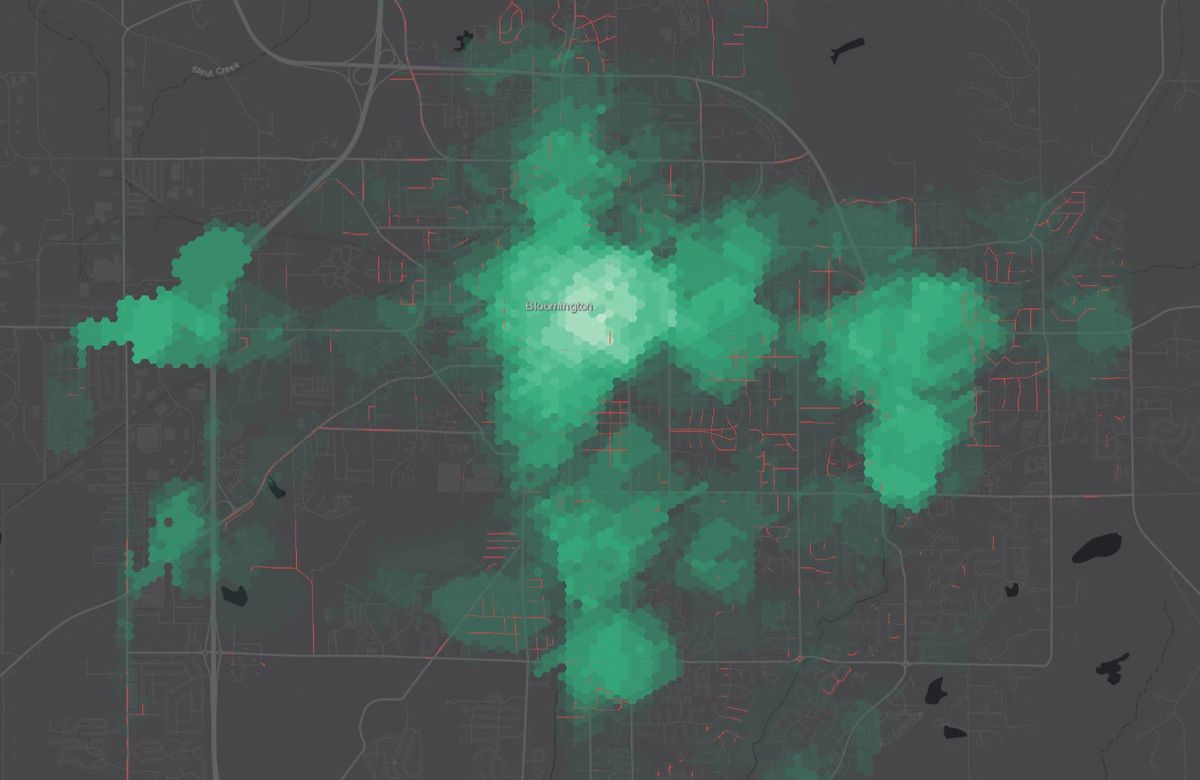
Defining walk potential
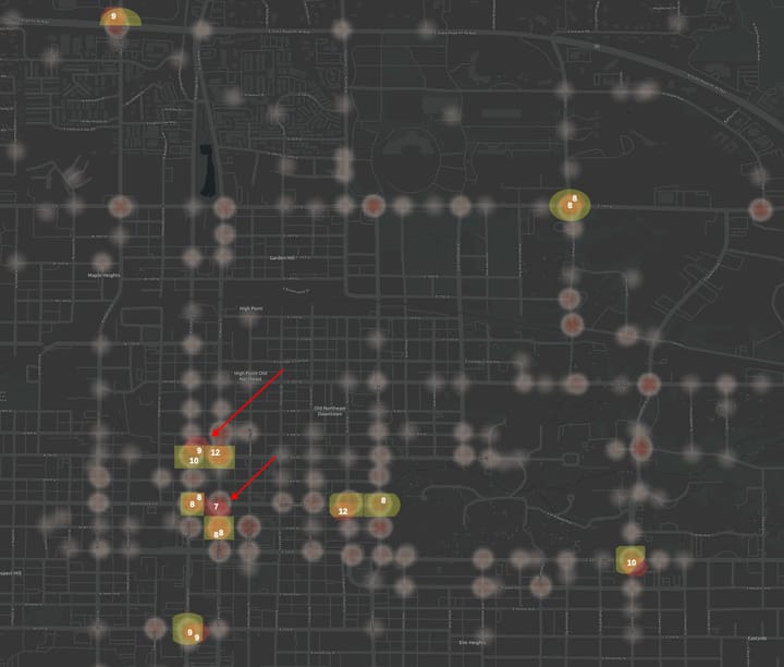
Locations with high walk potential have more categories of interesting destinations within a comfortable walking distance.
Walk potential doesn't measure walkability because the comfort of the walk is not considered. A neighborhood with no sidewalks across a wide, busy street from a strip mall might have high walk potential but poor walkability.
Think of walk potential as measuring demand (places to walk to), while walkability measures pedestrian supply (a comfortable walking environment).
Calculating walk potential is useful for urban planning. For example, to prioritize adding sidewalks in locations that have high walk potential yet lack sidewalks.
How walk potential is calculated
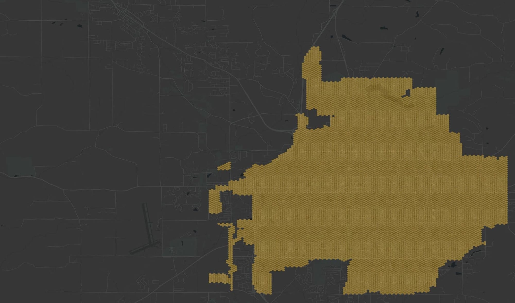
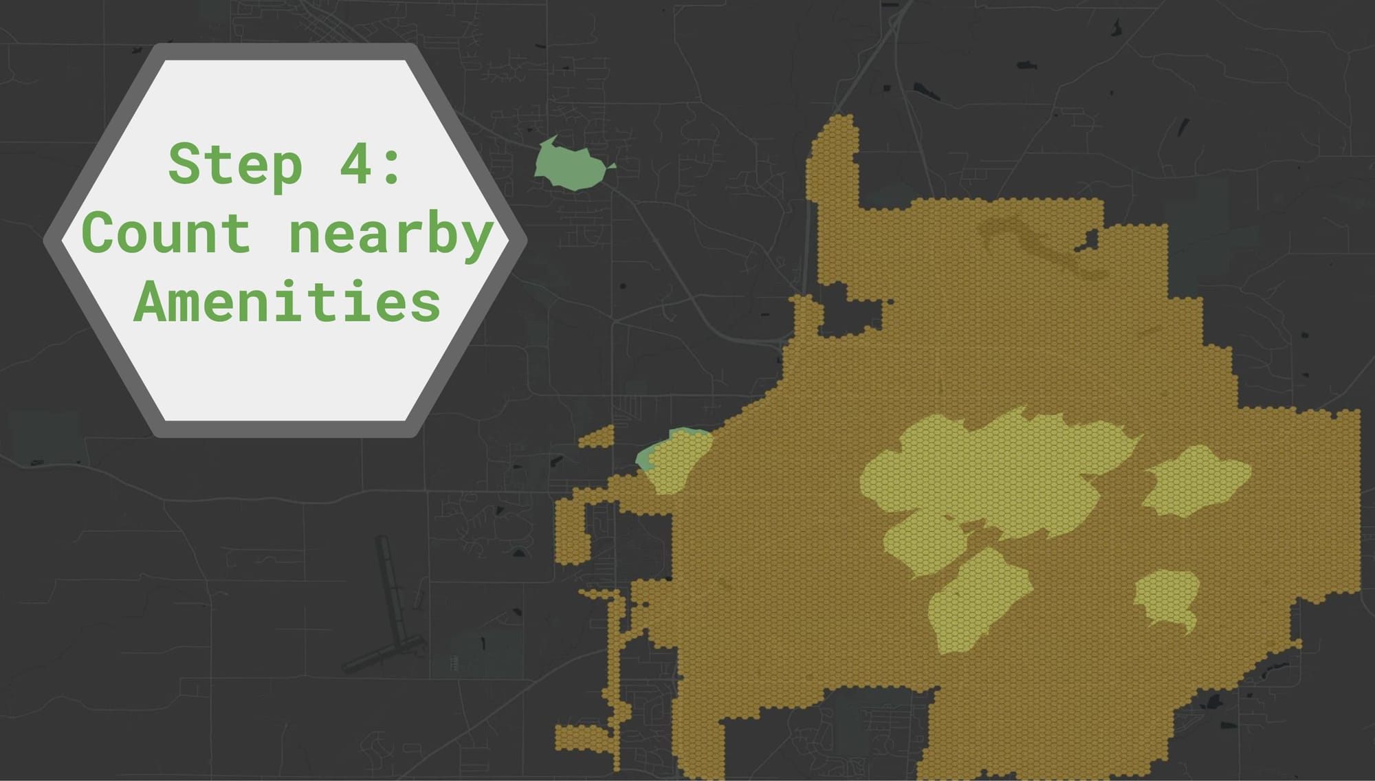
- A hex grid is generated that covers the entire city.
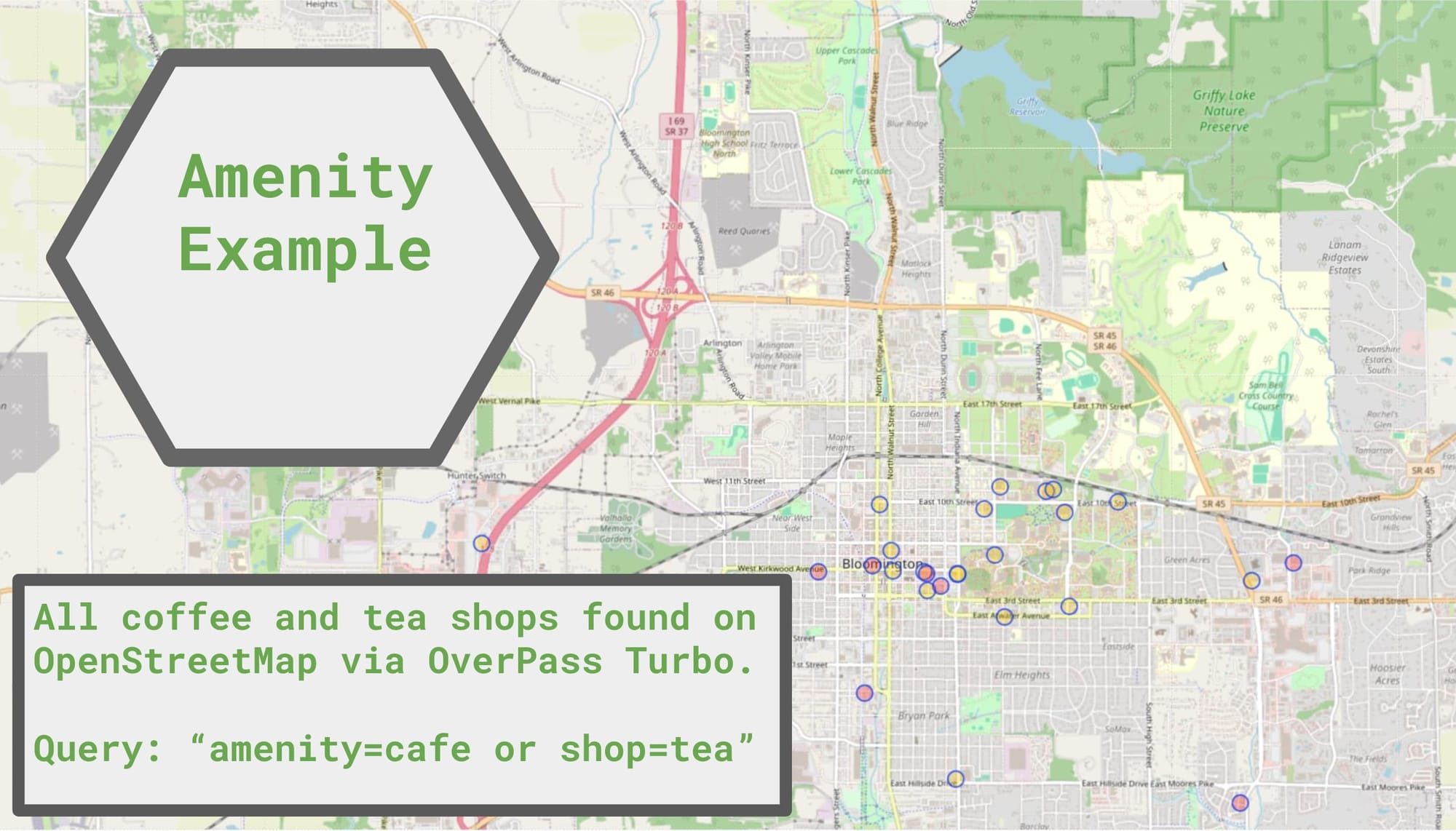
- For each of the 21 categories of amenities defined below, OpenStreetMap is queried to find all the locations of those amenities within the city boundary. The result of each of these is an "amenity layer".
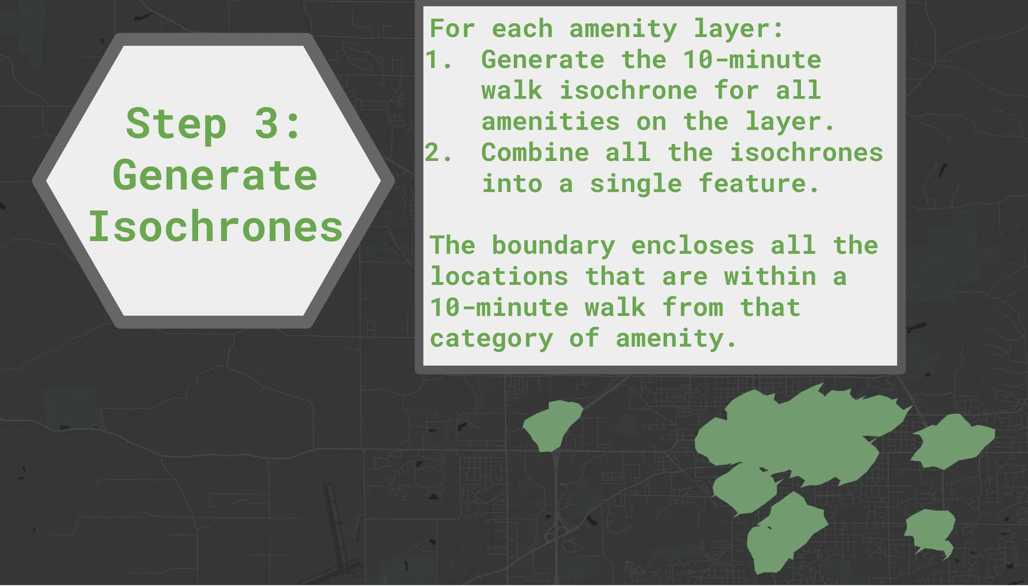
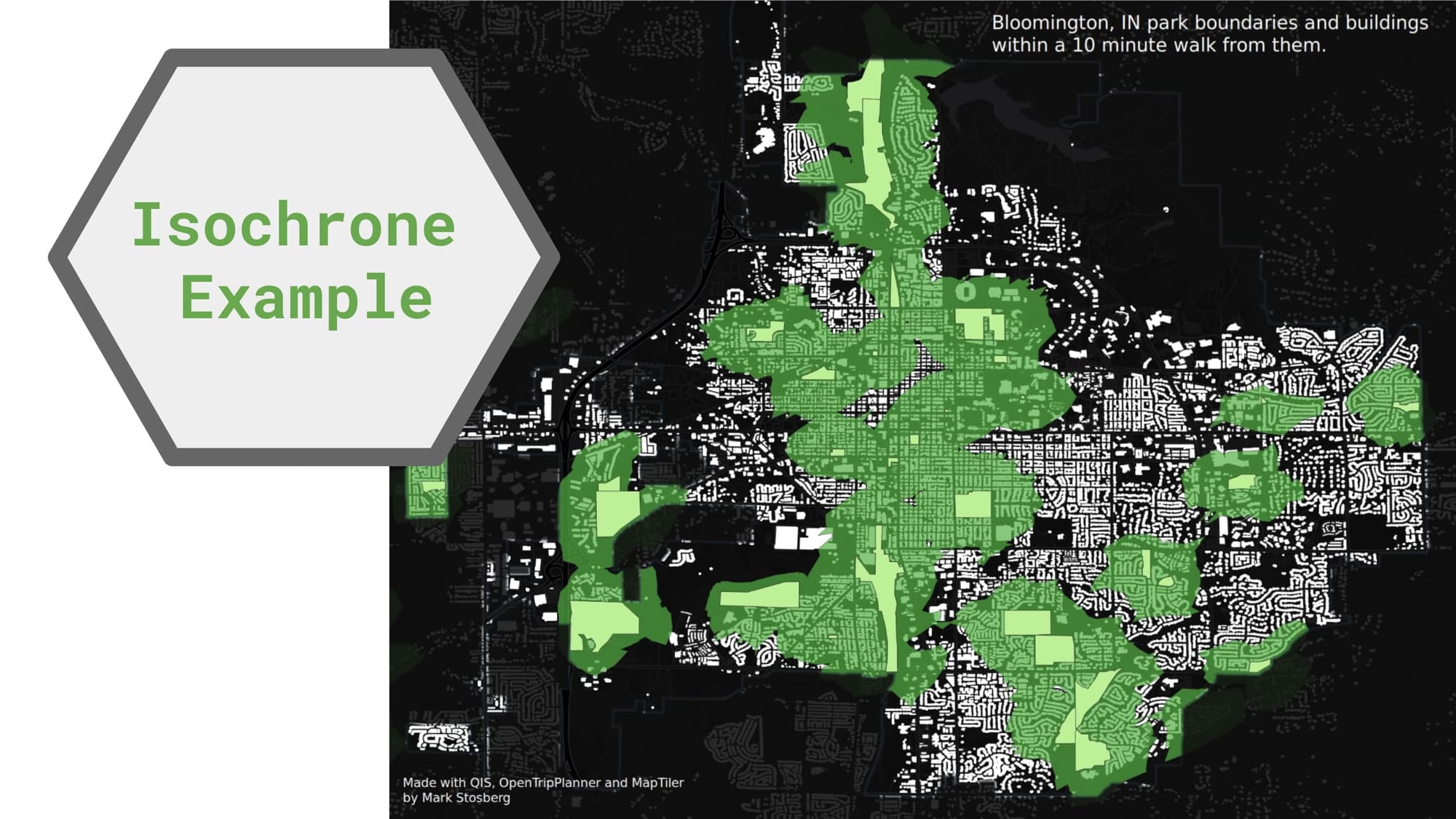
- For each amenity layer, call OpenTripPlanner to generate the 10-minute walk isochrone for all amenities on the layer. Combine all the isoschrones into a single feature. The boundary encloses all the locations that are within a 10-minute walk from that category of amenity.
- For each location in the hex grid start with a walk potential of zero, and check whether the center is within each amenity layer's isochrone. Add one to the walk potential for each amenity layer that is within a 10-minute walk. The result is a value from 0-21.
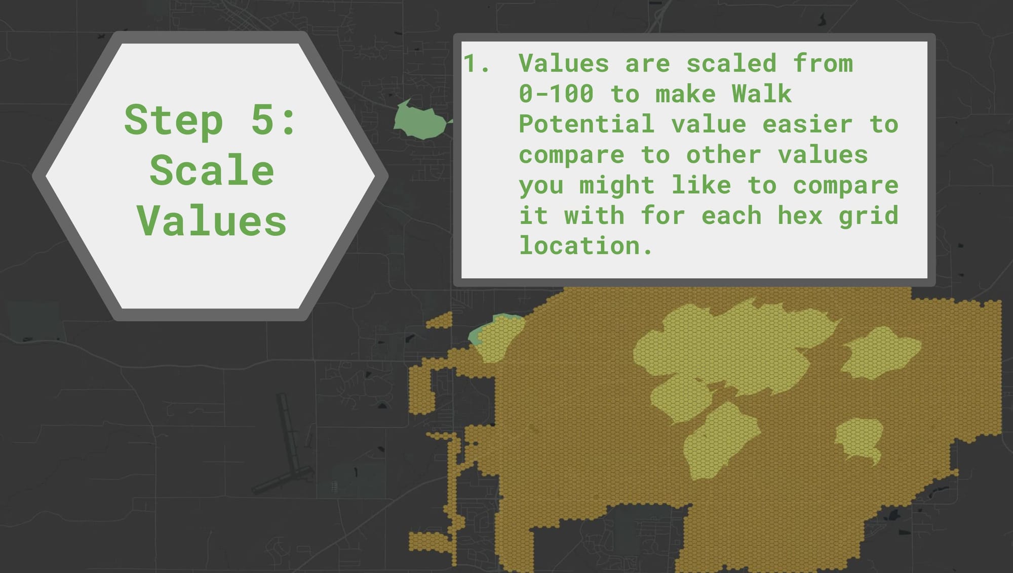
- Values are scaled from 0-100 to make the walk potential value easier to compare to other values you might like to compare it with for each hex grid location.
Comments ()