The past and future of bike/ped connectivity to Cascades Park
In a recent interview, Mayor Hamilton said "our transportation plan says we need to have a Bike Ped Trail from Miller Showers and then kind of though the center of College and Walnut and on north up to Griffy and all that."
What does Bloomington's Transportation Plan say about a bike/ped trail through Cascades?
The proposal doesn't appear in the narrative of the 207 page document, but it does appear in a map and is mentioned in a 72-page appendix. Here's the map where it appears as as proposed multi-use path:
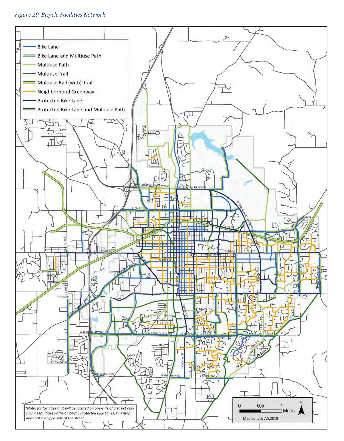
The mayor mentioned the connection to Griffy Lake as part of the priority, but the plan includes three other new bike/bed connections to Griffy Lake as well: Dunn Street, Headley, and a new trail off what's now Discovery Parkway.
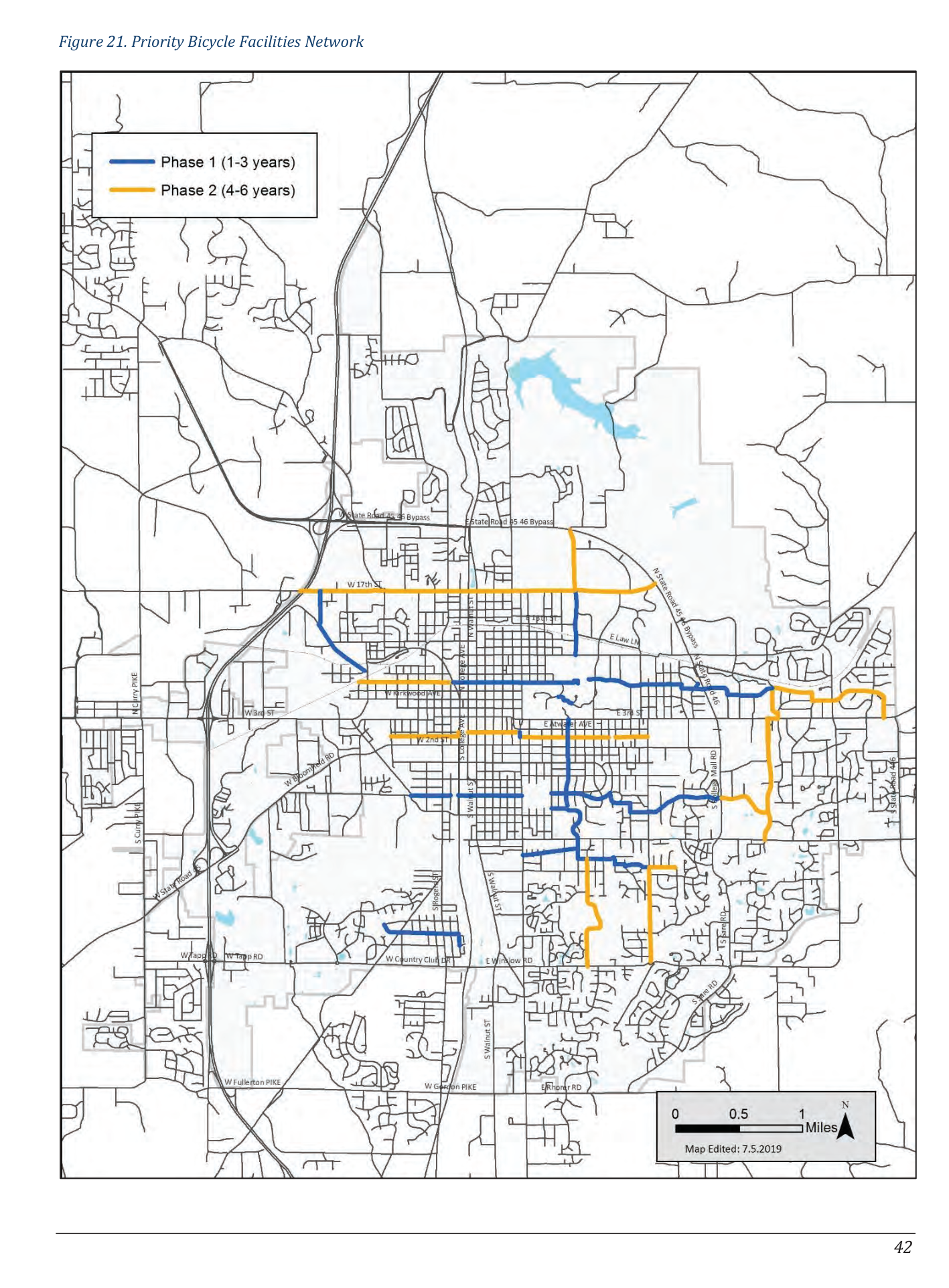
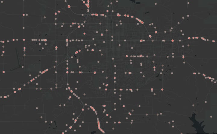
There's another map where the Cascades multi-use path does not appear, which is the "Priority Bicycle Facilities Network". The map highlights projects prioritized in the next 1-3 years and 4-6 years. Considering the plan was adopted in 2019, those are the projects prioritized by the plan through 2025. Here's the map.
Here's the other mention of the project in the 72-page appendix, which is a long table which goes on like this:

If you are wondering what the column names means, you'd have to scroll back up 12 pages or so to find out. Only the first of the 72 pages of the table includes the header explaining the columns. Here's that header:
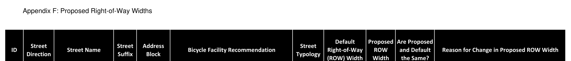
If you put the two together, you'll find that buried in the 72 page table is a proposal to reduce the right of way through Cascades by 12 feet to make way for a multi-use bike path.
How did the Cascades proposed multi-use path become a proposed road closure?
When the rubber met the road of planning the facility, it's clear there's not room to add a 12-foot multi-use path through Cascades as planned in what's already a narrow gorge that is prized for it's natural character. Closing a section of the road to car traffic is alternative which would meet the goal at considerably less expense and natural disruption. Given the minimal mentions in the original plan, it's easy to to see how the implications of this project might have been missed on a city-wide map or in a 72-page table without per-page headers.
What's the climate impact of the proposed road closure?
Given that the proposed change is driven by the long range plan's emphasis on the climate crisis, it's interesting to estimate the climate impact of the proposed road closure. During the trial road closure, City staff analyzed impact with an "User Experience" survey and a "User Impact" survey, but the project web page doesn't mention anything about a climate-impact analysis.
Comparing driving directions to the playground from south of the bypass before and after the change shows that the driving distance would be 150% longer while requiring only 2 minutes of additional time in each direction:
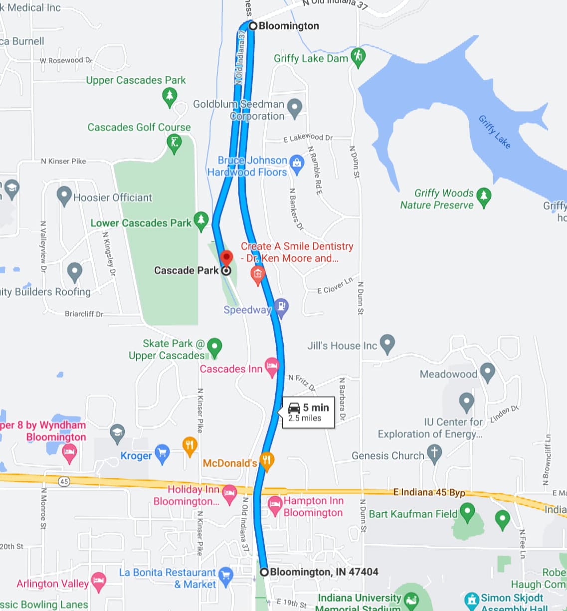
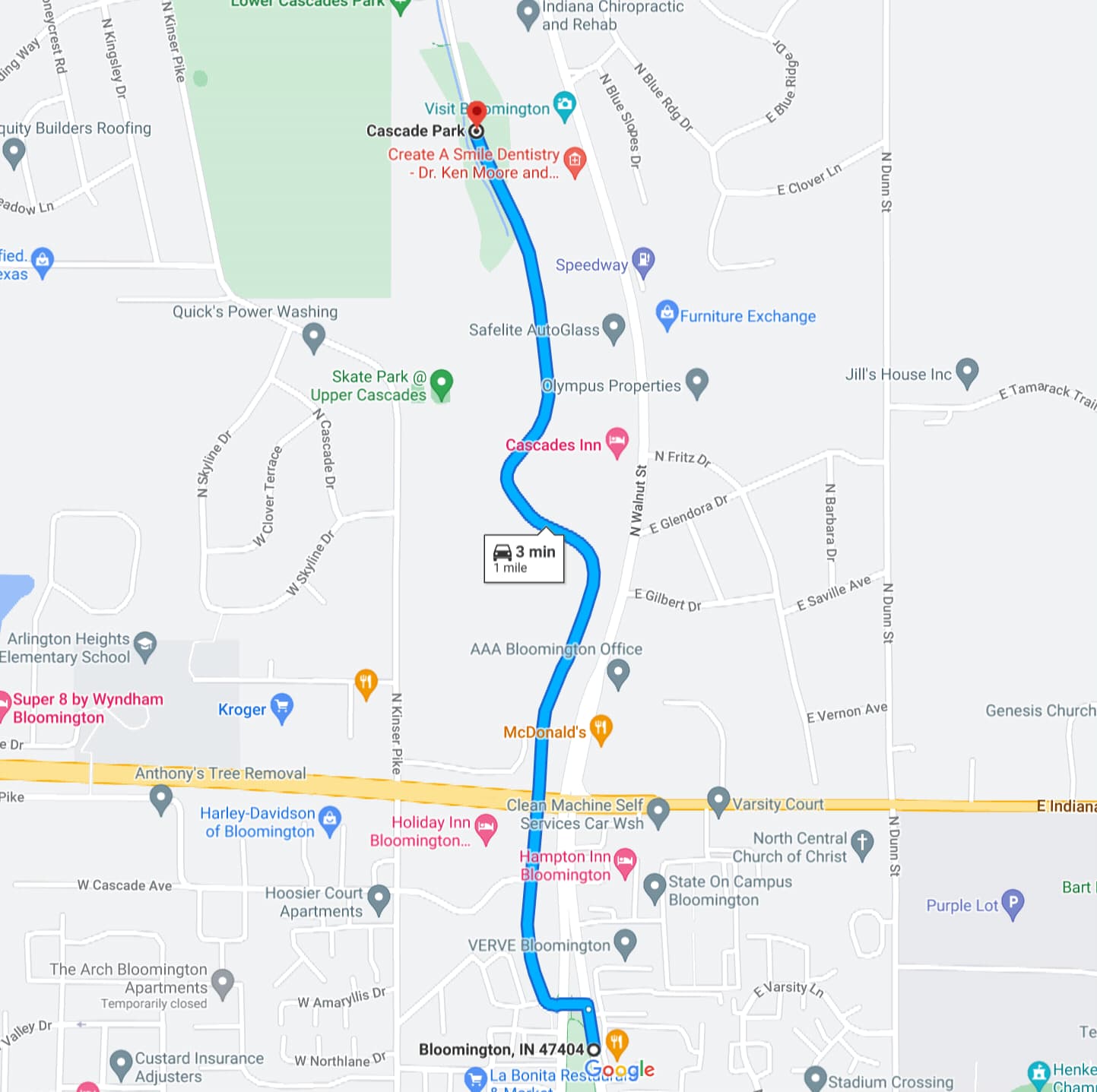
Two minutes of extra driving seems unlikely to dissuade many drivers, yet there are clearly more emissions involved in taking the longer route. A recent analysis of walking to the park found that a road closure is unlikely to convert many people to walk to the park, because the closest houses don't have good connectivity. Driving through the park is almost the same distance as driving down Walnut, so emission savings can't be expected by closing this alternate route. For game day traffic, the alternate route may reduce emissions by providing a more efficient alternative to idling in grid-locked traffic.
So an overall emission reductions would have to come from a significant shift to people biking there instead of driving or a significant reduction of people who go out of their way to drive through Cascades Park, some of whom visit that way due to mobility issues.
The road closure is not a clear climate win and that impact hasn't been studied closely to confirm.
Can the City change course on a long range plan?
Here's a quote from the plan itself:
So, the 2019 plan recommends that it be reviewed in amended in 2024. Given the speed at which government moves, that means it's about to time for that process to start.
Are there alternatives to closing the Cascades Park road which could meet the goals of the long range transportation plan?
The executive summary of the Transportation Plan opens with a reminder of the importance of addressing the climate crisis and how transportation mode shifts can contribute to that. Five years later, that remains an important goal.
In the last five years, the City of Bloomington has improved the walking and biking experience at Cascades Park with speed cushions along the road an improved waterfall trail. Could a 2024 revised plan consider the speed cushions a sufficient upgrade upgrade to improve biking to Cascades Park?
A closer study of pedestrian access to Cascades Park found that the people most likely to walk there are the people who live next to it, but closing the road won't help most of them access it by foot. The best way to reduce car trips from neighbors to the park is to connect the the park to adjacent neighborhoods with new trails to the neighborhoods, not along the road.
The climate impact of closing the road remains unclear. Gains would have to more than offset the 150% longer driving distance from the south.
Conclusion
Since the 2019 Transportation Plan was approved, there have been some significant upgrades to the walking and biking experience in Cascades Park despite it not being on the list of projects to prioritized through 2025.
Logistical and financial challenges were also identified with adding a multi-use path to Cascades Park, while multiple new ways to improve pedestrian access were also identified that have received positive reviews from impacted neighbors polled on Nextdoor.
Given this context, it seems prudent to pause the consideration of closing Cascades Road until the next iteration of Bloomington's Transportation Plan can be drafted, which could happen as soon as 2024.
Comments ()