Bike Tour Journal: Richmond, Indiana to central Kentucky and back 2007
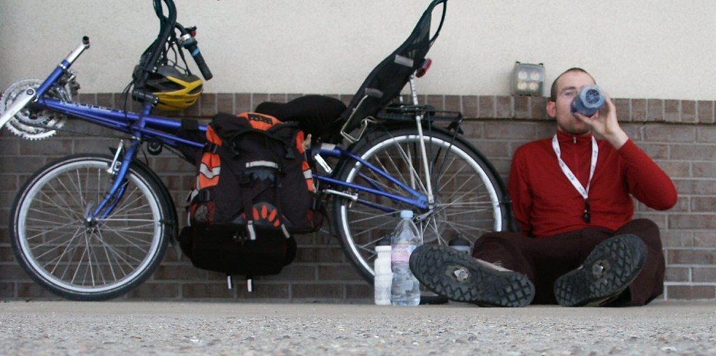
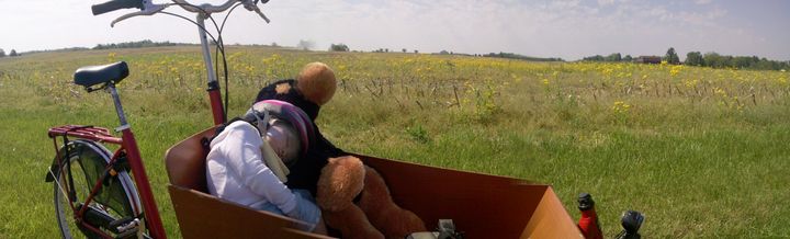
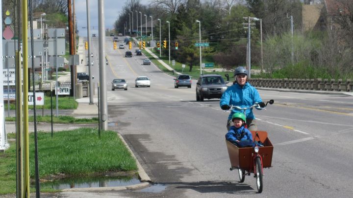
This was a 293 miles (472 km) trip over 8 days from May 12, 2007 to May 19, 2007 on a RANS V-Rex recumbent bicycle.
Introduction
Howdy, here are some notes from my most recent bicycle tour. I'm writing with an audience of current and potential bicycle tourists in mind.
This was my first week-long self-designed tour. In the past I had added my own extensions to Cover Indiana and GABRAKY. Unfortunately, on both of these organized rides, I experienced some knee problems, and the fixed distances and schedules left me feeling locked into the event schedule.
By organizing my own trip, I had the flexibility to redesign the trip on the fly and use a more personally meaningful route— riding from my home to visit family and friends in central Kentucky, about 150 miles away.
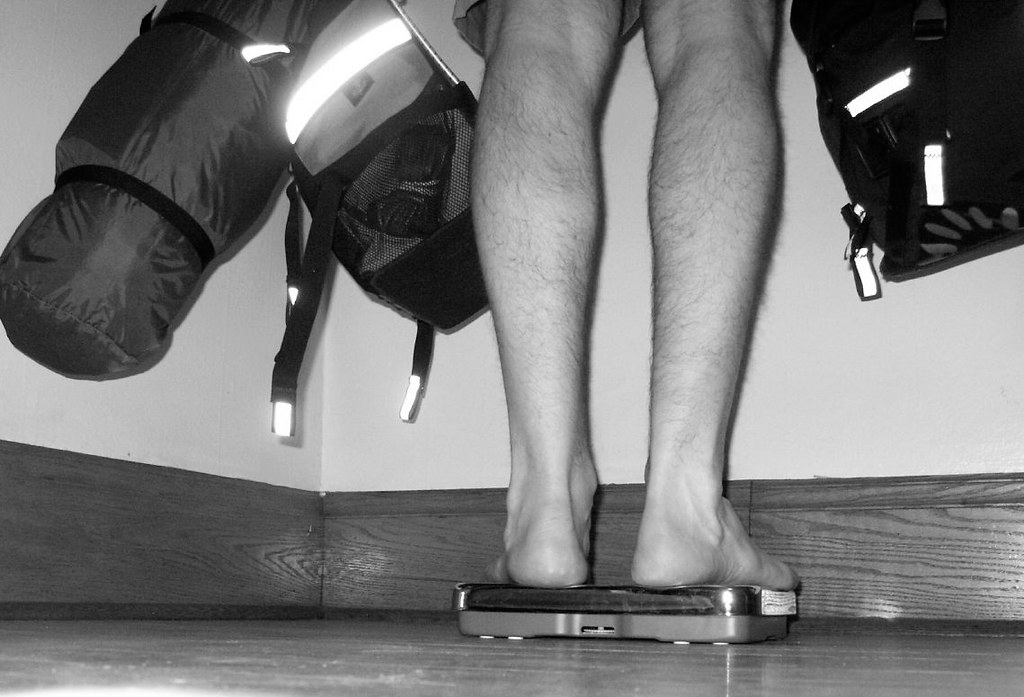
Two weeks before the trip I test-packed my bags and commuted with them to work. I chose the Bridge Avenue route which has a steep hill on it. As fate I would have it, I combined a number of ingredients that morning to create an ironic pill: The extra load, the steep hill and the cold morning combined with a lack of warm-up and a possible improper bike fit. The result created a minor injury of its own...even before I left.
Dave Tanner was kind enough to advise me on how to proceed. I completely reversed my training leading up to the trip. Instead of training with increasing weight and distance until I approximated the 75 mile days I would being doing, I rode a minimal amount, focusing on my resting and recovering my knee instead, rather than risking further injury.
That approach worked in terms of knee recovery, but it certainly compromised my training— the longest day I had ridden for the season so far had been only 20 miles, to train for the Earlham triathlon.
I made a significant trip redesign. I dropped two nights of camping in a state, park. That dropped 10 pounds of camping gear. I replaced camping with overnight stays with a WarmShowers.org host in the Cincinnati area.
My on-board pharmacy seemed to have more knee recovery aids than my multi-purpose bike tool had Allen wrenches. There was the knee brace, Aleve for inflammation, Arica tablets and Arnica cream for sore muscles, and Ginseng endurance pills. I had never taken the Ginseng pills before, but Kurt said they might help...and, hey, they might.
Now, rather than drag you through the drama of the blow-by-blow Arnica cream applications, I spoil the ending that my knees worked fine. They were a little sore after the first two days in particular, but felt fine again by morning. While in Lexington, Kentucky, Dave from Scheller's bike shop was gracious enough to give me a free bike fit tune-up. He suggested moving the seat a bit further away from the pedals would help a bit, and it seemed to. I was concerned that this position caused my achilles to be used to point me toe just a bit at the bottom of the stroke. He explained "this is small job for a small muscle...it's not a problem...legs weren't built pedal in circles all day". Okay, so that's more a paraphrase than a quote.
Packing List
I've found it useful to read other people's bike tour packing lists to see what they choose to bring, and what they do without.
For those who are interested, here's what I eventually chose to bring in my two bags on this trip.
Clothing
- Chaco sandals -- to wear off the bike
- cycling socks (2 pair)
- wool long sleeve shirts (1)
- short sleeve wool t-shirt (1)
- Beyond pants ( rain pants / dress pants )
- cargo shorts (1 pair)
- cycling shorts (1 pair)
- light weight dress pants ( sun protection / dress pants )
- Swim suit
- underwear
Weather
- Spare Heavy-Duty garbage bags
- Spare grocery bags
- Dry bag, for extra electronics protection
- Marmot rain jacket
- bill cap (sun protection)
- sun glasses ( didn't need them...bill cap was enough )
- bandana (didn't use it )
- thin full-fingered glovers ( for sun protection, mostly )
- thin fleece headband
- Pannier rain covers (2)
- Bread bags (for my feet if it rains)
- latex gloves (emergency use for cold rain...didn't happen)
Healthcare
- * Aleve (Helpful for aching knees)
- * SPF Chapstick (To prevent and recover from wind and sun-burned lips!)
- * Spare TP for emergencies
- * toothbrush
- * Small first aid kit
- * moist towelettes (2, great for cleaning chain grease off hands)
- * a little corn starch in a ziploc bag (for chafing)
- * Arnica tablets ( for sore muscle recovery ...didn't use )
- * Iodine tables (emergency water purification...didn't use )
- * travel size sun-block
- * travel size aloe vera, for sunburn recovery
Bicycle
- rear blinky light
- Tool kit
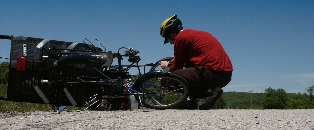
- Spare tubes ( I did get a flat...)
- Lightweight combination bike lock (could have gotten by without it. )
- Maps
- 3 water bottles
Food
I tried to limit myself to about one days worth of food. I usually had at least the following on board. Figs, dates, and baby carrots with hummus were other favorites.
- trail mix
- granola bars
- fruit
- Plastic fork ( didn't use. )
- Plastic spoon ( didn't use )
Hobbies / Misc
- Headlamp ( for emergency night riding use...didn't need it. )
- Notebook
- magazine ( didn't read! )
- Pen
- Cell phone, charger
- Digital camera and cable
- Ubuntu Linux LiveCD ( I did use this because one place I stayed had Windows, which couldn't read the USB card from the camera. Once I booted from the LiveCD, I had no problem. The network settings were also taken care of automatically I easily posted the photos to Flickr ).
- USB stick
- Business cards
- Three juggling balls
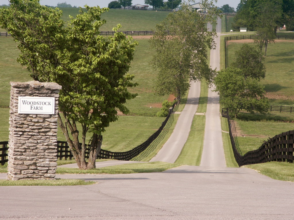
Richmond, Indiana to Florence, Kentucky via Fairfield, Ohio
Saturday May 12, 2007, 76 miles (122 km) - Total so far: 76 miles (122 km)
For my first day, I planned to ride about 75 miles from Richmond, Indiana to Florence, Kentucky, with a lunch stop at Jungle Jim's international grocery story in Fairfield, Ohio.
The route took me down 227 in Indiana, which becomes 177 at the Ohio border. It's a mostly flat country road, but becomes uncomfortably busy out the outskirts of Hamilton. Here the traffic is heavy, traveling at 55 mph, with no shoulder.
In Hamilton, I connected with 4, which eventually leads to downtown Cincinnati after turning into Vine and then Spring Grove. These all have two lanes of traffic in each direction, so there is room for cars to get around. They worked OK for urban commuting on a Saturday afternoon. I imagine at rush hour I would seek quieter side streets.
I crossed the river on the Anderson Ferry. A local cyclist suggested I approach it via Hillside Drive, rather than staying on River Road. This is a quiet, efficient detour that I would recommend, going only about a block out of the way. Having waiting only about five minutes for the $1 ferry ride, I completed a very long, steep, slow and scenic climb up the roads of Point Pleasant and Mineola. It felt challenging at mile sixty of the day's ride. Overall, I decided I would rather take this direct route up the hill than to add several more miles finding an alternative that was not as steep.
Florence, Kentucky to Frankfort, Kentucky via 42 and 127
Sunday May 13, 2007, 74 miles (119 km) - Total so far: 150 miles (241 km)
My ride from Florence, Kentucky to Frankfort, Kentucky was another day of about 75 miles. I chose the direct route of taking the main roads of 42 and then 127 south. 42 was a pleasant hilly course on that Sunday morning. As I left Florence, there were even bike lanes at times. Soon however, there were no shoulders to speak of. At a busy time, I expect this road may be unpleasant for cyclists, combining the lack of a shoulder, higher car speeds, and shorter visibility due to curves and hills.
I was excited to find myself next to the river eventually on 42, only to realize that I'd just dropped back into the river valley that I just climbed out of the day before. Sure enough, as I turned south on 127, there was a long hill climb, but the grade was light compared to Mineola road!
Overall, 127 was a fine cycling road with wide shoulders, newer pavement, and no particularly steep grades. Also, as a main road, there were no loose dogs! The exception to this was the northern section starting around Glencoe, which lacks a shoulder and has some steeper grades. There's a long climb to get out of Glencoe to the south, with a grade a little steeper than normal. I spent over 10 minutes moving slowly up this single hill!

Owenton was about half way through the route and made a nice break. I didn't bother to research any local places to eat, and restocked a grocery store on near edge of town, and ate lunch at Subway, which was also on 127. Unfortunately, buying both a footlong sub and a six-inch sub didn't fill me up, so I had a couple more granola bars from my bike before I got on the road again.
Frankfort, Kentucky to Lexington via Old Frankfort Pike
Thursday May 17, 2007, 40 miles (64 km) - Total so far: 190 miles (306 km)
Old Frankfort Pike is a direct and scenic route between Frankfort and Lexington, offering many views of the kind of horse farms you may have seen on post cards of Kentucky. There are a number of hills and curves to slow down traffic, but I was unfortunately traveling it around rush hour on a Thursday afternoon. While I highly recommend the route for classic Kentucky views, I frequently pulled off the road to let faster moving traffic pass on this trip. In one alarming moment, I heard tires screeching behind me. Someone speeding in a two seat convertible had just discovered me after bounding over the crest of hill. The car stopped in plenty of time, quickly recovered, cross the double yellow line into oncoming traffic, passed me and continued speeding on their way. Sigh.
Lexington, Kentucky to Cincinnati, Ohio and points beyond
Saturday May 19, 2007, 103 miles (166 km) - Total so far: 293 miles (472 km)
After spending a day in Lexington with friends, I headed back towards Florence along 25 on a Saturday morning. I was pleased to find such a direct route, which more or less follows the route of I-75. Traffic was heavy and sometimes unpleasant as I got of the of metro Lexington area. After that, 25 became rural, scenic, quiet and enjoyable. And still no loose dogs!
I hadn't noticed any towns of significant size that looked like promising lunch stops from my maps, so I packed a lunch of hummus and baby carrots for myself. As it turned out, there were a number of gas-station / mini-groceries along the route tha t would have worked OK for food if I had wanted to travel lighter. It turned out that I had stopped for a picnic lunch just a couple miles south of Corinth, where there was just such a well-stocked gas-station/deli, complete with farmers discussing something important on the front porch.
Maps.ask.com's walking directions provided a nice alternative way to get into Florence, which I imagine was quieter than continuing on 25 for the last leg.
As it turned out, I arrived in Florence only to find it was a bad time for company for my prospective host. I decided to continue on as far as I could towards Richmond, Indiana, rather than staying over in a motel and continuing on Sunday.
Returning to the ferry the steep, winding roads of Mineola and Point Pleasant were now downhill, and provided some much enjoyed high speed coasting.
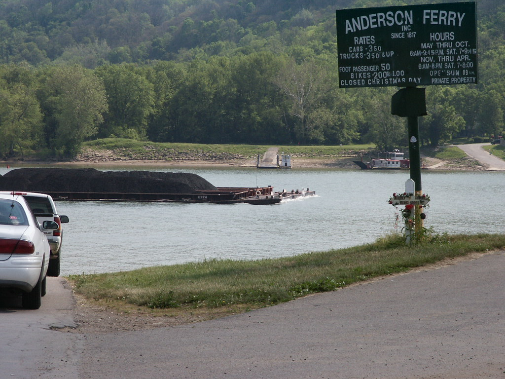
I suspected Anderson Ferry Road would also be a steep road on the Ohio side, and hatched plans to meet a pickup driver on th e ferry and have that person haul me up the hill. But as I descended Mineola, I realized just how long and steep the climb w as in the other direction. I had made that fine, even at the end of a long day on the bike. So, I decided to tackle climbing Anderson Ferry Road without help. With 85 miles already under my belt that day, I started the climb. It was indeed and lon g and steep. For the first time on the trip, my shirt became nearly soaked with sweat, although I was going only 3 or 4 mile s per hour of the hill! At least traffic was no problem, as the uphill lane was extra wide, giving cars plenty of pass.
I reflected painfully that this is the catch with shortest-distance directions— The shortest distance up a hill is straight up it!
Eventually the climbing ended and I jagged over to North Bend road, continuing north. I wound through a neighborhood, seeing my first cyclist on the road for the day. Perhaps he was surprised as I picked up the pace for the few blocks our paths overlapped. I was just happy to some companionship on the road, but he didn't seem to care. Around another corner was a child's lemonade stand business in a front yard, with the family overseeing the sales from the porch.
As good as some lemonade sounded, my legs pulled me on around the corner with a mind of their own.
My next major turn was west onto Blue Rock Road, which turned out to be a very pleasant way to get out of the city. While Route 4 was full of sprawl, traffic and stop lights, Blue Rock was mostly residential with few stop sights and was downhill leaving the city.
With the momentum of the downhill runs of Blue Rock, I found I was soon in New Baltimore, Ohio, northwest of Cincinnati, outside of the 275 loop, less than 20 miles from Oxford, Ohio. My cyclometer reported 103 miles for the day. I had not fully exhausted my energy reserves, but decided to call it a day at an inviting picnic table near a rural factory. My wife was already on the road to pick me, and would arrive within a few minutes.
In those few minutes, at intersection of New Haven Road and Paddy's Run, I saw two serious recreational cyclists speed by. A factory worker who joined me confirmed they were common sightings. I made a mental note to investigate if this was part of a Cincinnati Cycling Club circuit, but have yet to follow up on that.
I was tired, but did not feel injured or any significant discomfort. We stopped in Oxford and I tanked up on a high-protein recovery drink and a large salad bar salad from the Kroger's there. I was hoping I wasn't going to regret the 100 mile day in the morning, with a headache, or other ill effects.
I was pleased to find I was fine the next day, just very tired. I wouldn't put a 100 mile day in the middle of a tour, but I was glad to find I could complete the distance if I had a reason to.
Now I'm looking forward to my next tour of the season.
Comments ()