Comparing Safety of Cascades Road and Gourley Pike Pedestrian Bridge
This post continues a series related to Cascades Road, in Bloomington, Indiana. See also: The past and future of bike/ped connectivity to Cascades Park and Three projects to improve pedestrian access to Cascades Park.
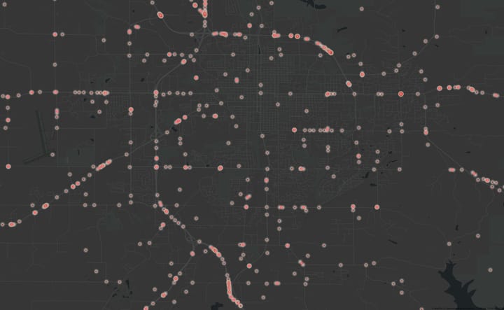
The Bloomington, Indiana City Council will be considering soon the closure of a section of Cascades Road to cars. So, it's interesting to review the number of times drivers in cars have crashed into people riding bikes or walking along the section proposed to be closed. We have crash data going back 19 years thanks to the Monroe County Crash Dashboard by Carson TerBush. Here's a map of all the crashes in that section. Each crash is represented a circle.... and there have been zero. No car-on-car crashes, no crashes involving bikes or pedestrians.
Quantifying bike trips through Cascades Park
So how many people have biked through without being involved in a crash with a car?
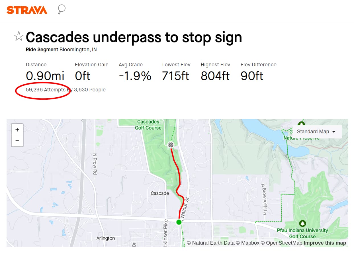
We have Strava app data going back about 14 years. Strava data doesn't include all bike trips– The data represents a portion of mostly recreational cyclists. With Strava, we can see nearly 60,000 recorded rides down Cascades Road. For an estimate that matches the 19 year time span we have crash data for, we need consider the five pre-Strava years. We also need to consider non-Strava trips. All together, it seems reasonable to estimate over 100,000 bike trips during the 19 years we have crash data for. And yet... there were no bicycle-involved crashes recorded. Keep in mind that the "speed cushions" are a recent traffic-calming addition. So, over the last 19 years the chance of being involved in a bicycle-involved car crash is north of 1 in 100,000. Assuming the speed cushions are working,, the risk of a crash is even lower now.
For context, we'll look at another nearby area next, which like Cascades Road, is part of a route that people could potentially use safely cross the bypass in this area.
Cascades Road a Safe Route to School?
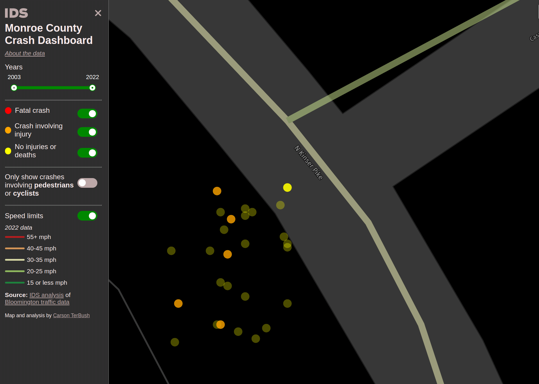
The road closure has been promoted as improving the safety of a safe bike route to Bloomington High School North. The data above shows the section closed was already crash-free. But to be safe route, you have to get all the way to the school. And if you are using Cascades Road, that means crossing Kinser Pike. The necessary crossing point is "uncontrolled". There's no stop sign there on Kinser Pike.
In context, this crossing is happening at "rush hour" for the road, as teen drivers race to get to the high school. According to the CDC, "The risk of motor vehicle crashes is higher among teens ages 16–19 than among any other age group". And the crash data we have for this intersection reflects that. There have been 26 crashes there in the last 19 years, many happening around the time school starts or ends. The reasons for the crashes include speeding, distracted driving, following too closely, and "driving too fast for the weather conditions". There have been no fatalities there in that time period, but if we are encouraging our children to be standing in that intersection waiting to cross, the odds will go up.
To sum up the safety impact of the proposed road closure as a safe route to school, it will improve the safety of a section that already had a flawless crash record before it already got the safety upgrade of traffic calming. Meanwhile, the most dangerous part of the route remains unaddressed. Promoting the road closure as a safe route to the school signals the whole route is safe, which it is not.
To add more context on safe routes to bike to Bloomington High School North, let's look at another route option to get there.
The Gourley Pike Pedestrian Bridge
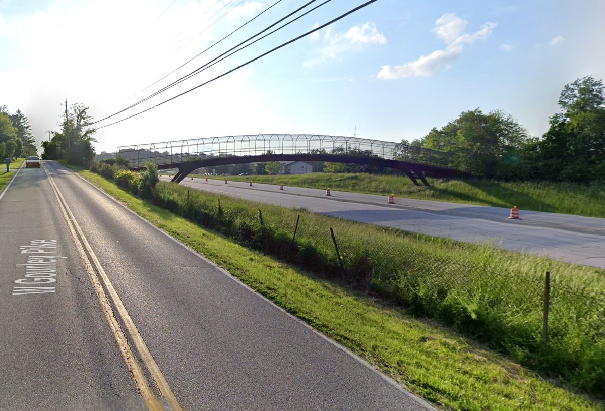
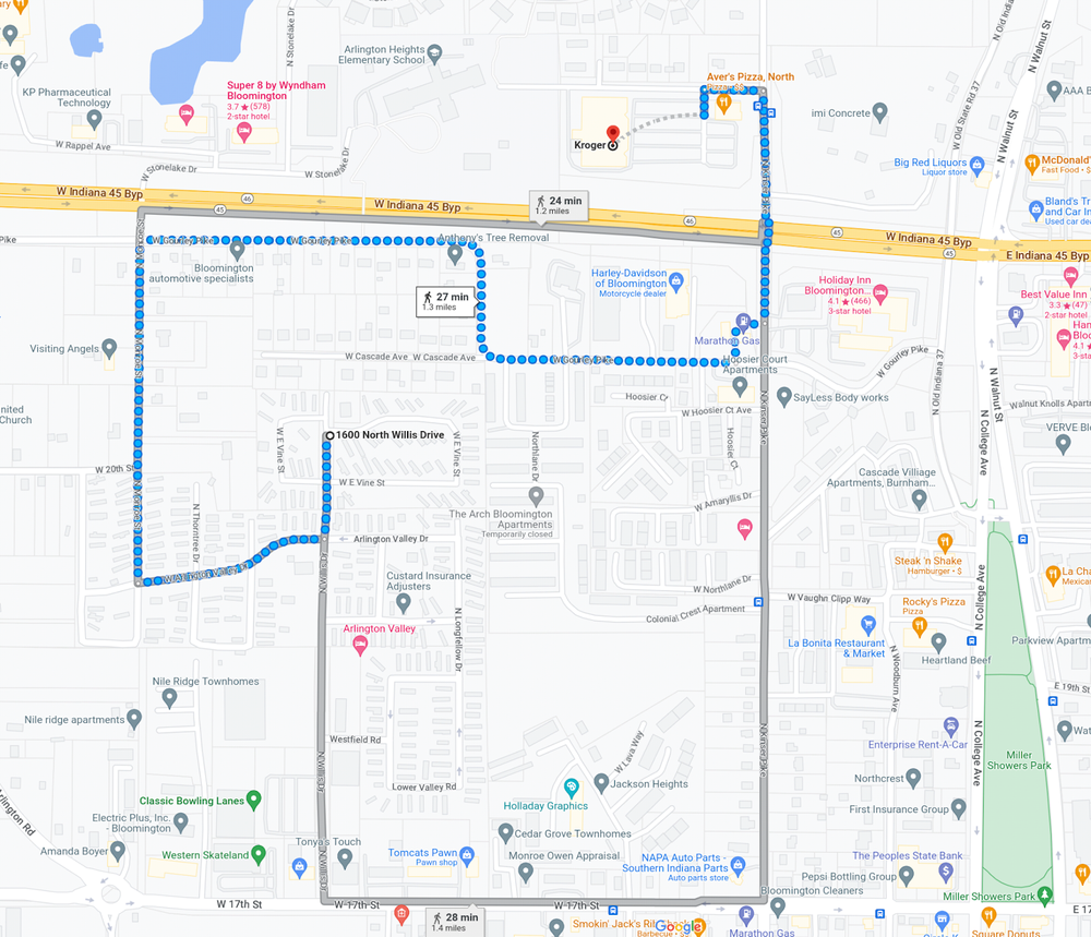
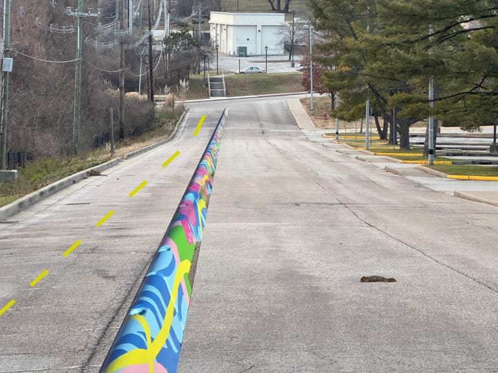
In a previous post, I wrote about the Gourley Pike Pedestrian Bridge– the pedestrian bridge over the bypass near Kinser Pike. On the south side, it just dumps you out on Gourley Pike, as seen in the feature photo for this post. No sidewalks. Fast traffic. Not much housing right there. Not useful.
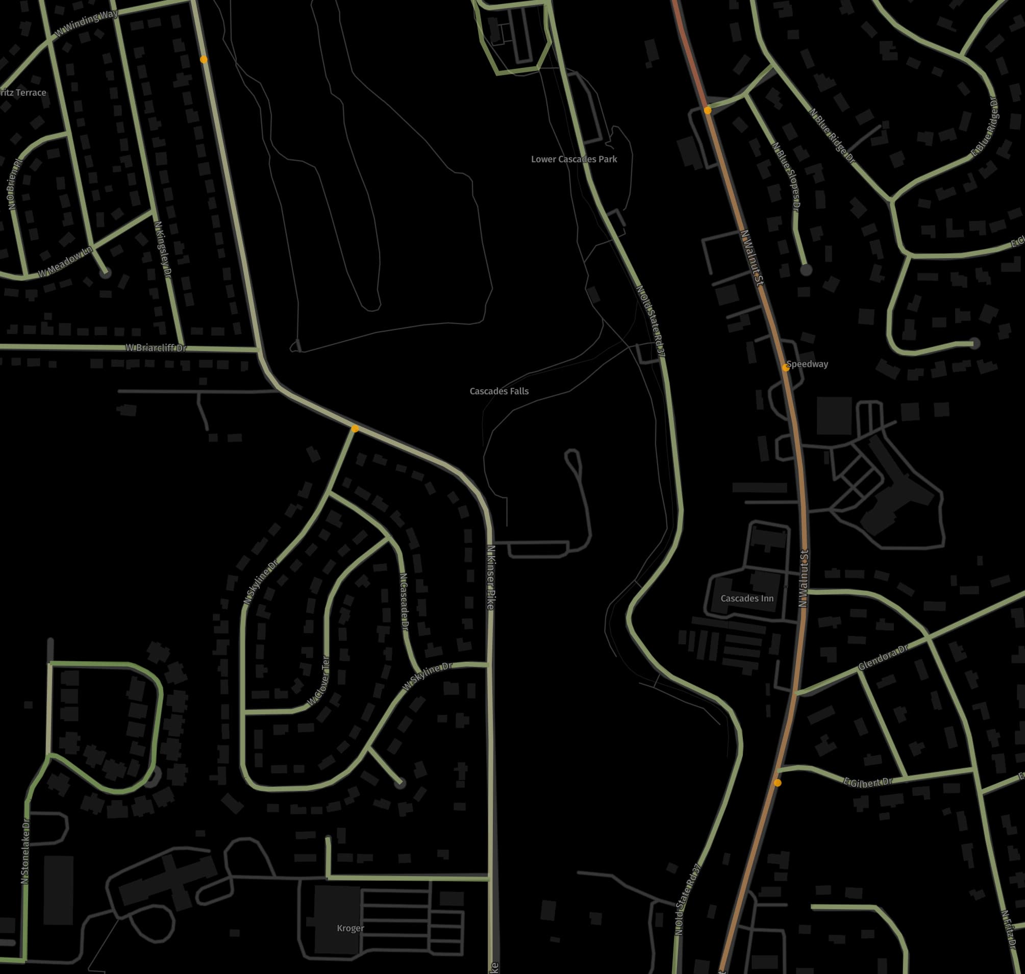
What this bridge has in common with the Cascades connection is that neither one was considered a priority project by the Bloomington 2019 Transportation Plan. There, priority projects were recommended to be completed within the next six years, by 2025. As I showed in the previous post, because conditions are not safe to access the Gourley Pike pedestrian bridge and there's no good connection with the Arlington Mobile Park, someone on Willis Drive would have walk far out of their way– over a mile– to get to Krogers, which would be more like a quarter mile walk if the connection to the pedestrian bridge was a complete. I'll repeat that map of that circuitous long walk here.
So what's the impact of not having a safe pedestrian crossing over the bypass in this part of town? Here's the map of pedestrian-involved crashes at Kinser Pike and the bypass– the likely crossing that people would use instead of the dysfunctional bridge.
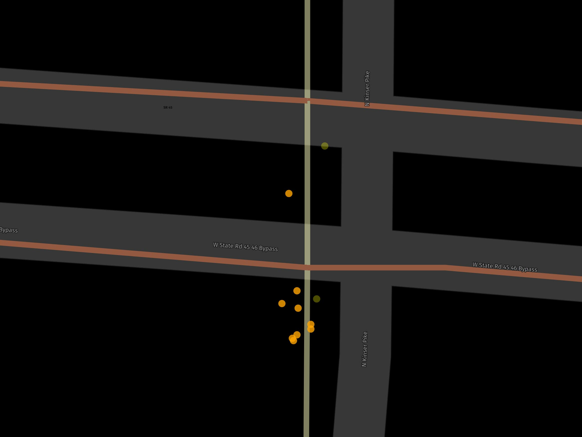
At a rate of more than once every two years, a pedestrian is struck by a car trying to cross the bypass here. There are destinations to walk to just across the bypass including Arlington Elementary, Krogers, Subway and Aver's Pizza.
To get a better sense of how dangerous the intersection of Kinser and the bypass is, here's the view of the crash map that includes all crashes at the intersections, including car collisions and two fatalities as red dots).
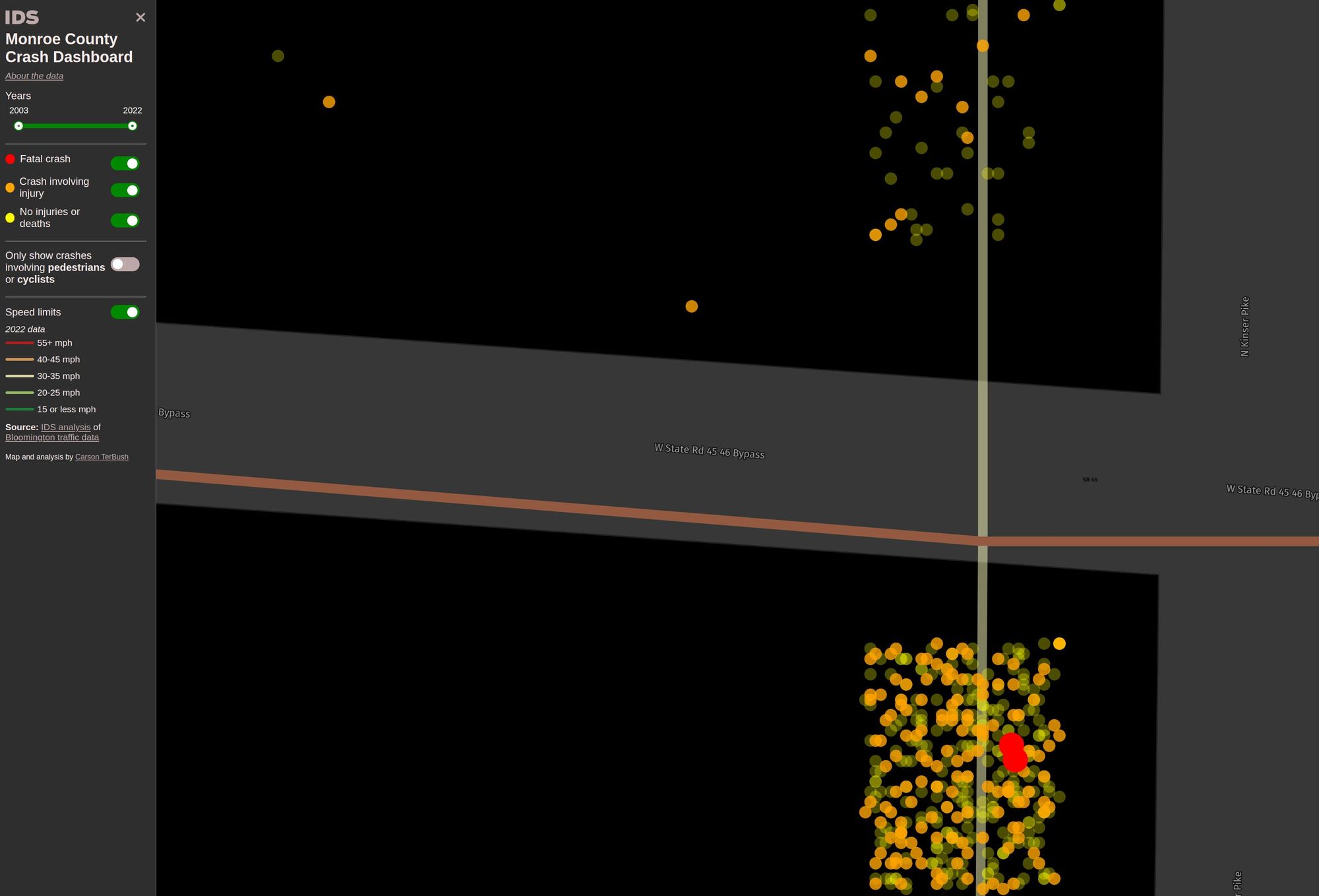
If trends continue, a pedestrian fatality here will predictably be added to the red dots already here. The fix to connect the bridge to the Arlington Mobile Park is already in our long range plan.
Conclusion
About twenty years ago, the Gourley Pike pedestrian bridge was built over the bypass and promoted as a "safe route to school", yet the whole route was never fully developed. As a result, the bridge doesn't see as much use it could, and more pedestrians are crossing at Kinser, an intersection where are numerous crashes and even fatalities.
Now the Cascades Road closure is being promoted in a similar way. It improves the safety a section where there is a history of zero crashes, while leaving the most dangerous part of the route unaddressed.
More effective action to improve safe routes to high school would improve safety of the the most dangerous parts of the routes.
Comments ()